Ecological dead zones
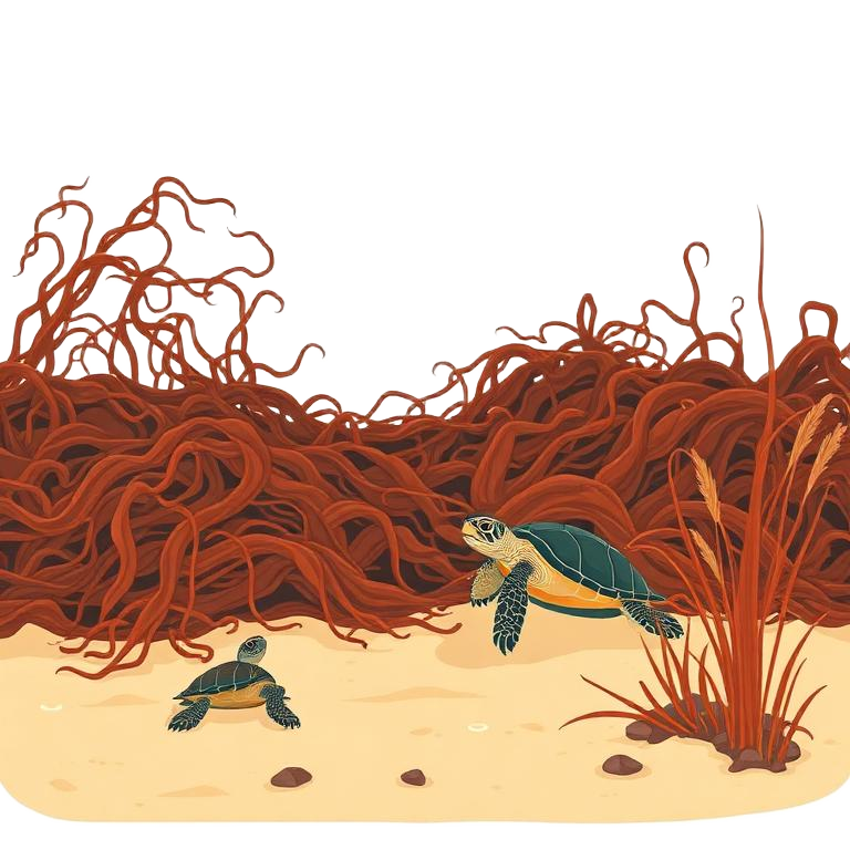
Dense mats block light and oxygen, driving seagrass loss and burying turtle nesting beaches under decomposing biomass.
One public ask. One growing coastal coalition.
Add your name to the federal request for a lawful, monitored way to intercept shoreward-bound Sargassum before it reaches beaches, canals and businesses.
0people on the record
Next public milestone: 100,000
Verified sign-ons from 0 recorded places. No donation is required.
Add your name — then tell your story and file a report.
Your next step
Four moves, in order. Each one makes the next person easier to reach — and makes the record harder for any official to ignore.
Ten seconds, two fields. Your name is added to the count that officials see.
Sign nowRuined vacations, headaches and breathing problems, cancelled bookings, lost crew days. What it cost your family, your guests, your season — testimony moves policy.
Share your storyPhoto, place, date. Every verified report becomes evidence on the public map.
File a reportGet your share kit and bring the business next door. One signature is hard — a block is a constituency.
Join and shareLive satellite
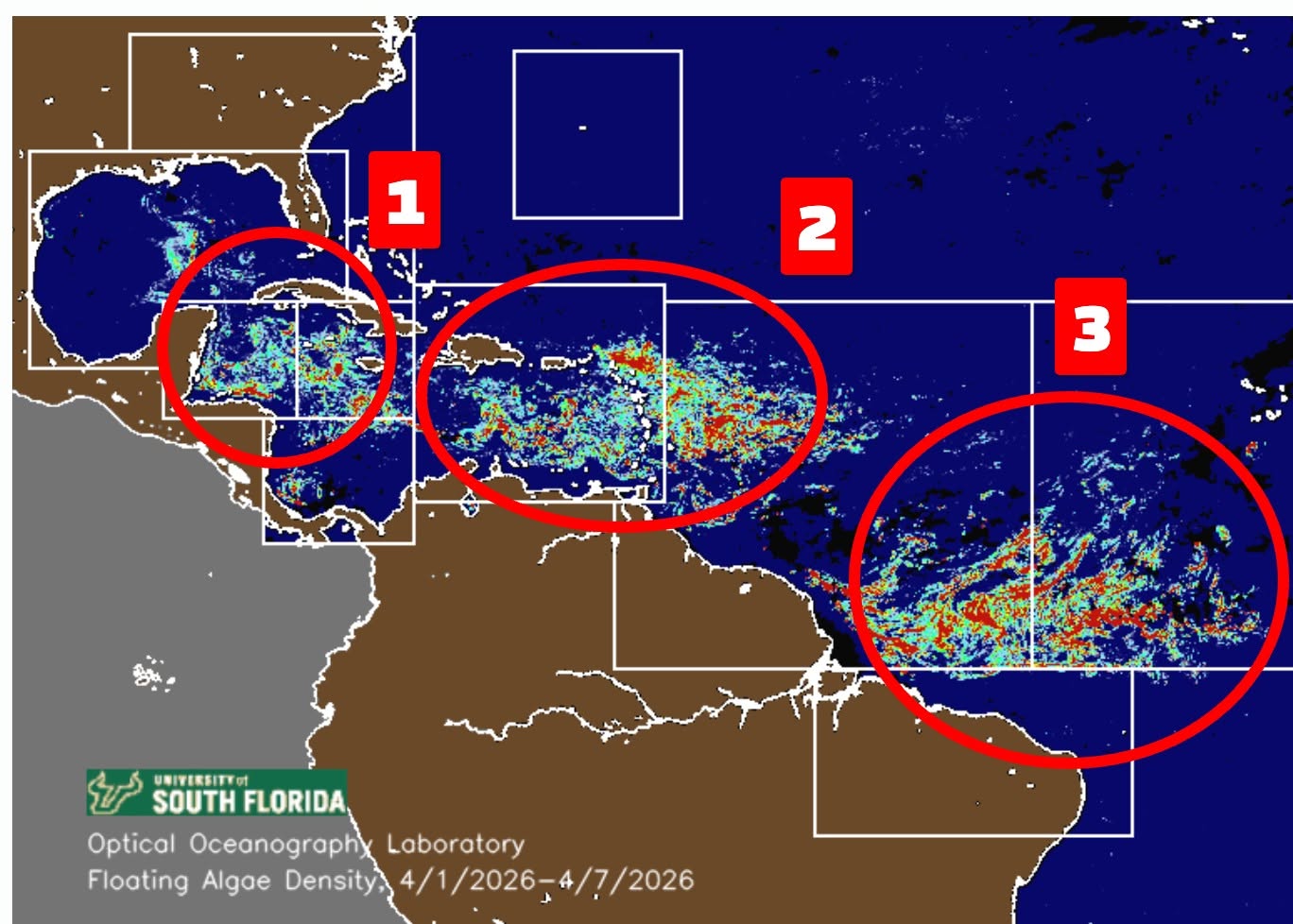
A rolling four-week satellite composite of floating-algae density across the Atlantic — updated weekly. Hover or tap the dots to step back week by week.
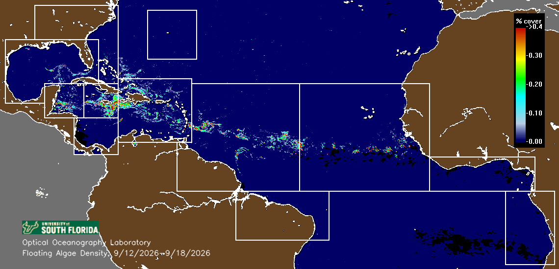
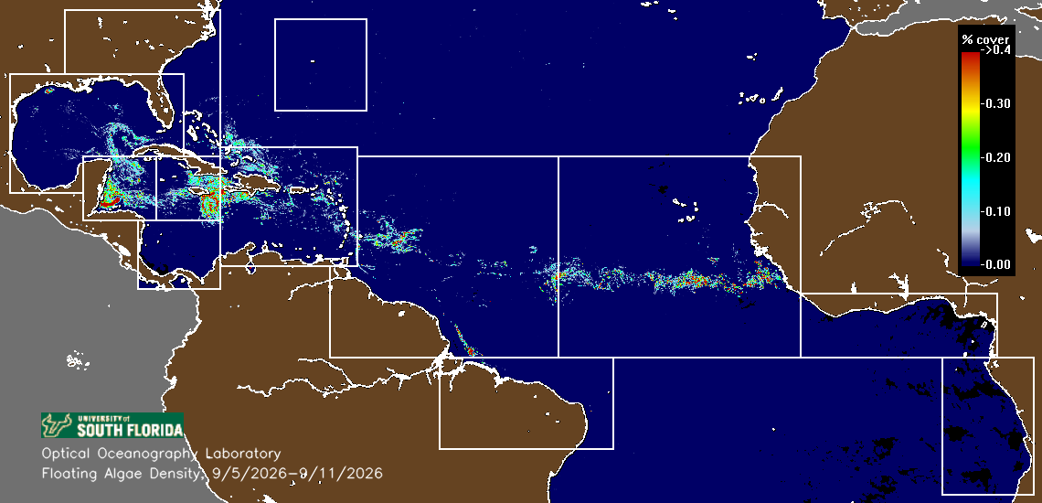
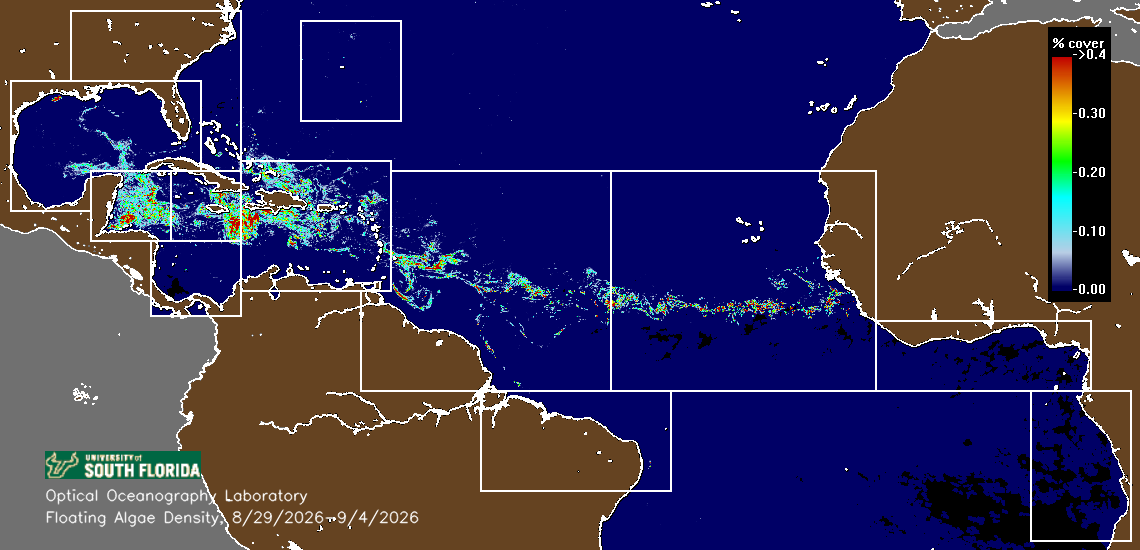
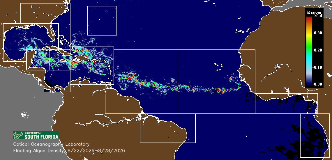
This is the same satellite record scientists use to track the belt: the brighter the signal, the denser the floating Sargassum. It is a reflectance index for algae on the sea surface — not tonnage, not a beach-level forecast, and it saturates under sun glint and cloud.
Data source
USF Optical Oceanography Lab — Sargassum Watch System (SaWS)
View the USF Sargassum Watch SystemImagery mirrored and displayed with credit to USF; the USF OOL is the originating source of the composite.
Your coastlines
Pick your flags and we move that shoreline's news, photos and video to the top. No account needed — it saves on this device and carries over when you join.
Tap the ones that matter to you. Use the globe menu for the full list of 20 shorelines and to set your home coast.
Start here
Sargassum is living offshore habitat. But when extraordinary accumulations reach shallow water, canals and beaches, they become a costly environmental, health and community emergency. Join the united voice demanding a lawful federal pathway to intercept documented shoreward-bound Sargassum before it reaches shore.
The modern crisis
This is not the historic Sargasso Sea. The record-breaking blooms now hitting the tropical Atlantic and Caribbean are a recent development — a new ocean system that did not exist before 2011.
2011
The primary starting point
Most scientific sources identify 2011 as the year the first significant, unprecedented bloom appeared in the tropical North Atlantic, detectable by satellite. That marked the birth of the Great Atlantic Sargassum Belt (GASB).
5,000–8,000 km
The belt today
The GASB now stretches from West Africa across the tropical Atlantic and Caribbean into the Gulf of Mexico — recurring, seasonal, and growing.
Drag to compare Pre-GASB 2000–2010 vs Recent GASB 2015–2023
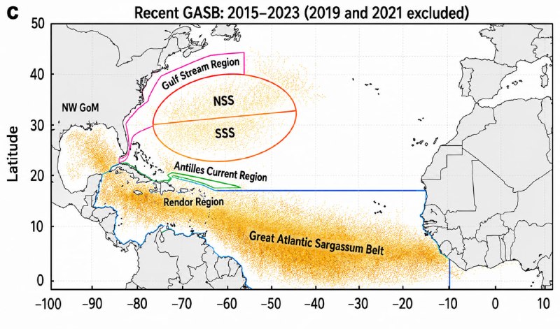
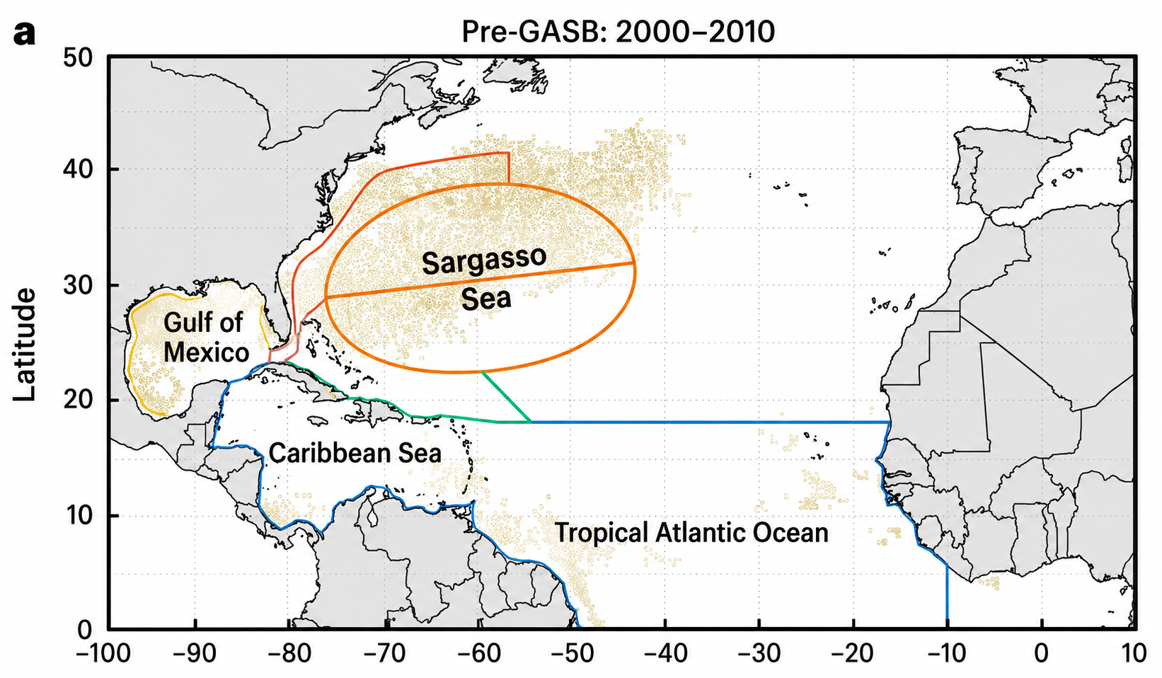 Pre-GASB 2000–2010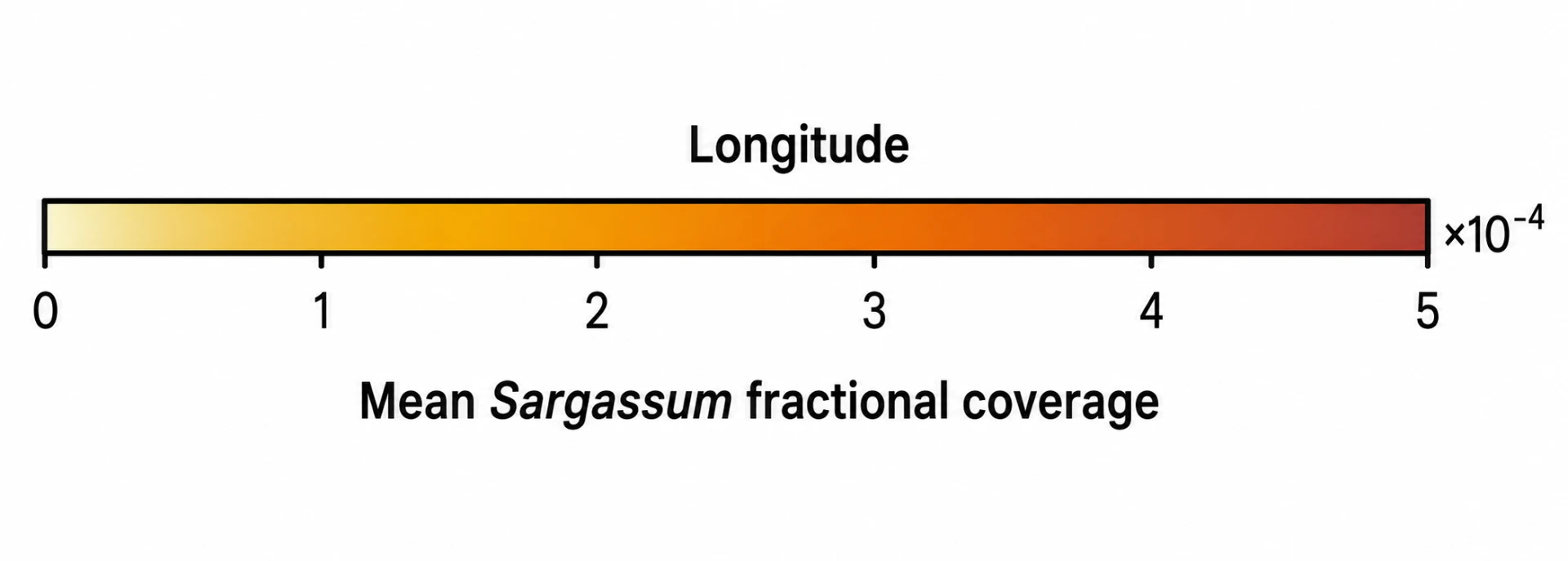
Step C · 2015–2023
The belt is now dense, continuous and recurring — 5,000–8,000 km from West Africa through the Caribbean into the Gulf. This is the regime we live in.
A 37-million-ton belt, documented inundations, and the point where habitat turns into hazard.
See the evidenceA lawful, monitored federal pathway to intercept documented shoreward-bound mats offshore.
Read the askDeep booms, wildlife safeguards and a circular economy that turns landed biomass into value.
See how it worksHydrogen sulfide exposure, tourism losses and what it costs the communities living with it.
Understand the impactThe turn
Dense mats block light and oxygen, driving seagrass loss and burying turtle nesting beaches under decomposing biomass.
Rotting Sargassum releases hydrogen sulfide. Cleanup, cancellations and infrastructure damage land on local budgets.
A 37-million-ton belt — the largest macroalgal bloom on Earth, visible from space.
Sargassum-fiber block is lighter than concrete and holds interior temperatures down — a use for what we intercept.
Processed biomass yields methane. Landed volume becomes a feedstock instead of a landfill tipping fee.
Bio-leather, organic fertilizer and food-grade thickeners are already being produced from harvested Sargassum.
The shift
Landed biomass, rinsed and composted, returns nutrients to farms instead of rotting on the sand.
Bio-bricks, biogas and bioplastics — value engineered out of the same mats we intercept.
Captains, crews, haulers and processors paid to work the problem, not just clean up after it.
Coastlines, canals and local economies that absorb a bloom season without shutting down.
The core distinction
We are not asking the public to choose between wildlife and communities. We are demanding a protected, transparent way to intercept extraordinary shoreward-bound accumulations before living offshore habitat becomes decomposing nearshore pollution.
Living pelagic habitat. Juvenile fish, turtles, crabs and endemic species depend on it. Nothing should be collected here.
Correct response: Protect and monitor. No intervention.
Distance to shore
> 50 nm
Mat density
Dispersed
Dissolved O₂
Normal
Intervention
None
Collection here would remove living habitat. This stage is a protect-only zone.
What is measured
C01 · Atlantic basin / Southeast Florida · June 2026
USF's satellite record documented severe southeast Florida beaching during the 2026 season, with the Great Atlantic Sargassum Belt at extraordinary abundance.
[S01] University of South Florida Optical Oceanography Laboratory
C02 · U.S. South Atlantic · 2003-2012 rulemaking, still in force
Pelagic Sargassum harvest is prohibited in South Atlantic federal waters south of the North Carolina-South Carolina boundary; north of it, harvest is tightly limited by area, season, observer, gear and annual-weight restrictions.
[S02] NOAA Fisheries[S05] NOAA Fisheries[S06] NOAA Fisheries
C03 · Big Pine Key, Florida Keys · FIU monitoring report
After canal removal at Big Pine Key Canal 266, organic content fell from 31.9% to 1.0% and average sediment depth from 154 cm to 40 cm; conditions later moved back toward baseline.
C04 · South Florida · 2025-2026
Decomposing Sargassum emits measurable sulfur compounds, and stranding studies document arsenic mobilization and enterococci in beach wrack.
[S12] University of Miami[S13] University of Miami / FIU[S14] Environmental Monitoring and Assessment[S15] Exposure and Health
Scale
3 nm
Atlantic state-water boundary
Federal pilot begins seaward of this line
9 nm
Gulf state-water boundary
Requires a separately designed pathway
31.9% → 1.0%
Canal organic content after removal
Big Pine Key Canal 266, FIU monitoring
$Millions
Modeled U.S. economic hit
NOAA NCCOS: PR, USVI and coastal Florida
The ask
Documented cases
Monroe County, Florida
USF reported severe southeast Florida beaching; Monroe County described a widespread Keys influx contributing to fish kills; Key West moved a public event because of odor; residents and marine professionals supplied dated photographs and accounts.
Big Pine Key, Florida
FIU treatment/control monitoring found organic content fell from 31.9% to 1.0% and average sediment depth from 154 cm to 40 cm after removal; conditions later moved back toward baseline.
Miami Beach, Florida
The city reports large 2026 removal volumes, daily management constraints, hotspot geography and the regulatory difficulty of in-water collection.
North Miami Beach, Florida
Florida DOH evaluated community complaints about rotting-seaweed odor and rashes and advised respiratory-sensitive people to avoid strong odors, while judging long-term open-air risk minimal.
Field video
Over 50 archived clips from TikTok, Reddit, Facebook and X — every one tagged to a country, region, beach and date.
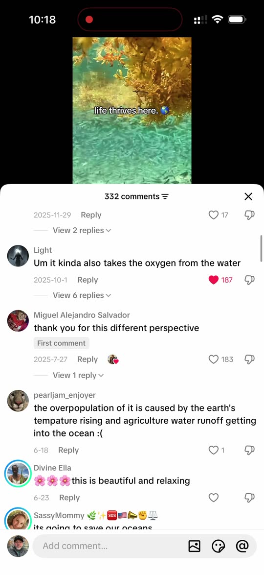 🌍 Atlantic basin
tiktok · @comments · 6 Aug 2026
“Life thrives here” — 332 comments on the habitat argument
Great Atlantic Sargassum Belt
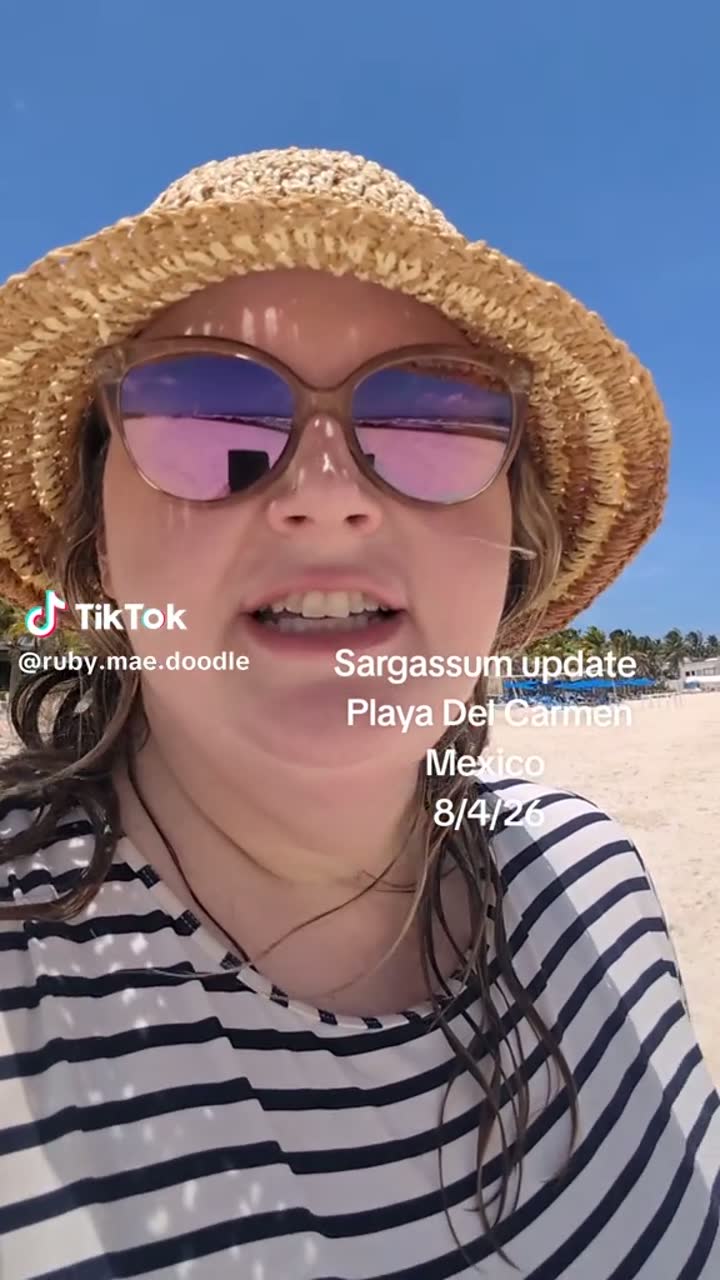 🇲🇽 Mexico
tiktok · @ruby.mae.doodle · 4 Aug 2026
Playa del Carmen sargassum update, 4 Aug 2026
Playa del Carmen, Quintana Roo
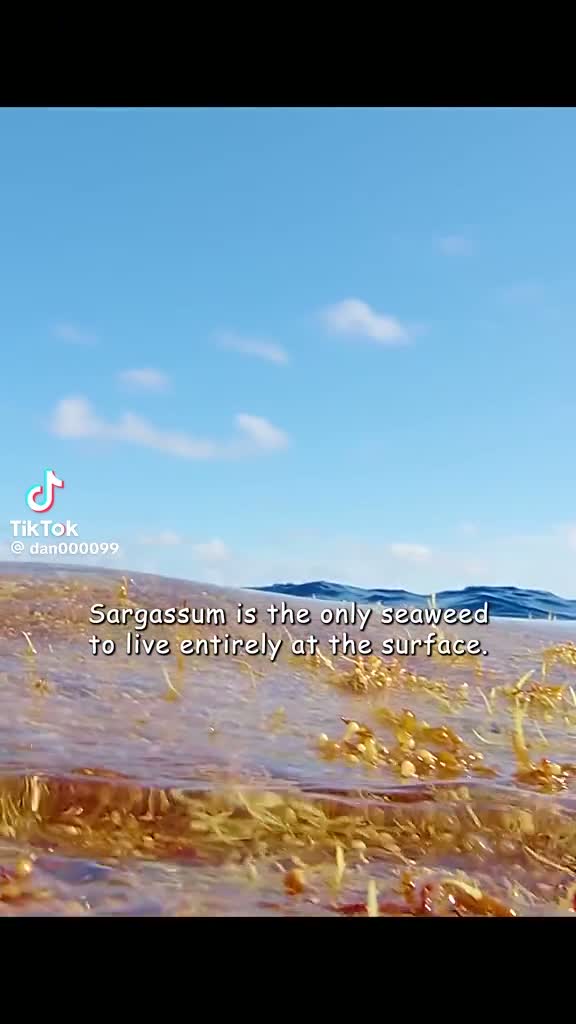 🌍 Atlantic basin
tiktok · @dan000099 · 2026
The only seaweed that lives entirely at the surface
Open Atlantic surface raft
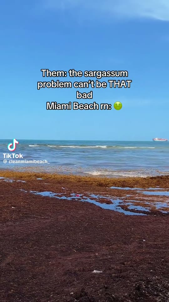 🇺🇸 United States
tiktok · @cleanmiamibeach_ · 2026
“The sargassum problem can’t be THAT bad” — Miami Beach right now
Miami Beach, Florida
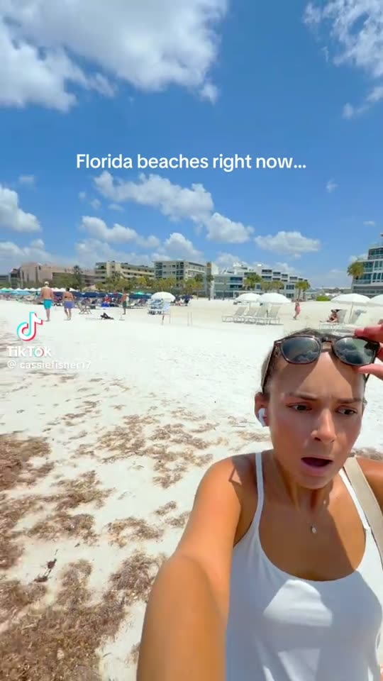 🇺🇸 United States
tiktok · @cassiefisher17 · 2026
“Florida beaches right now…”
Sarasota County beaches, Florida
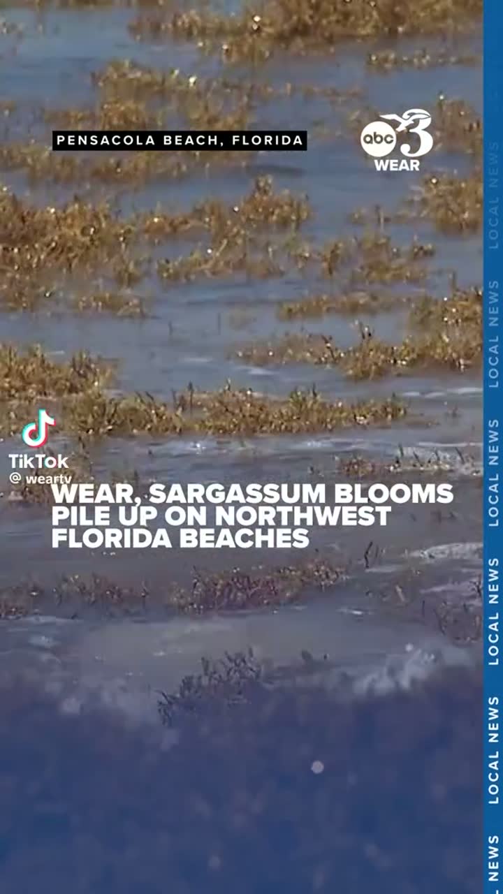 🇺🇸 United States
news · @weartv · 2026
WEAR-TV: blooms pile up on northwest Florida beaches
Pensacola Beach, Florida
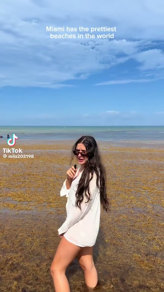 🇺🇸 United States
tiktok · @mila202198 · 2026
“Miami has the prettiest beaches in the world”
Miami, Florida
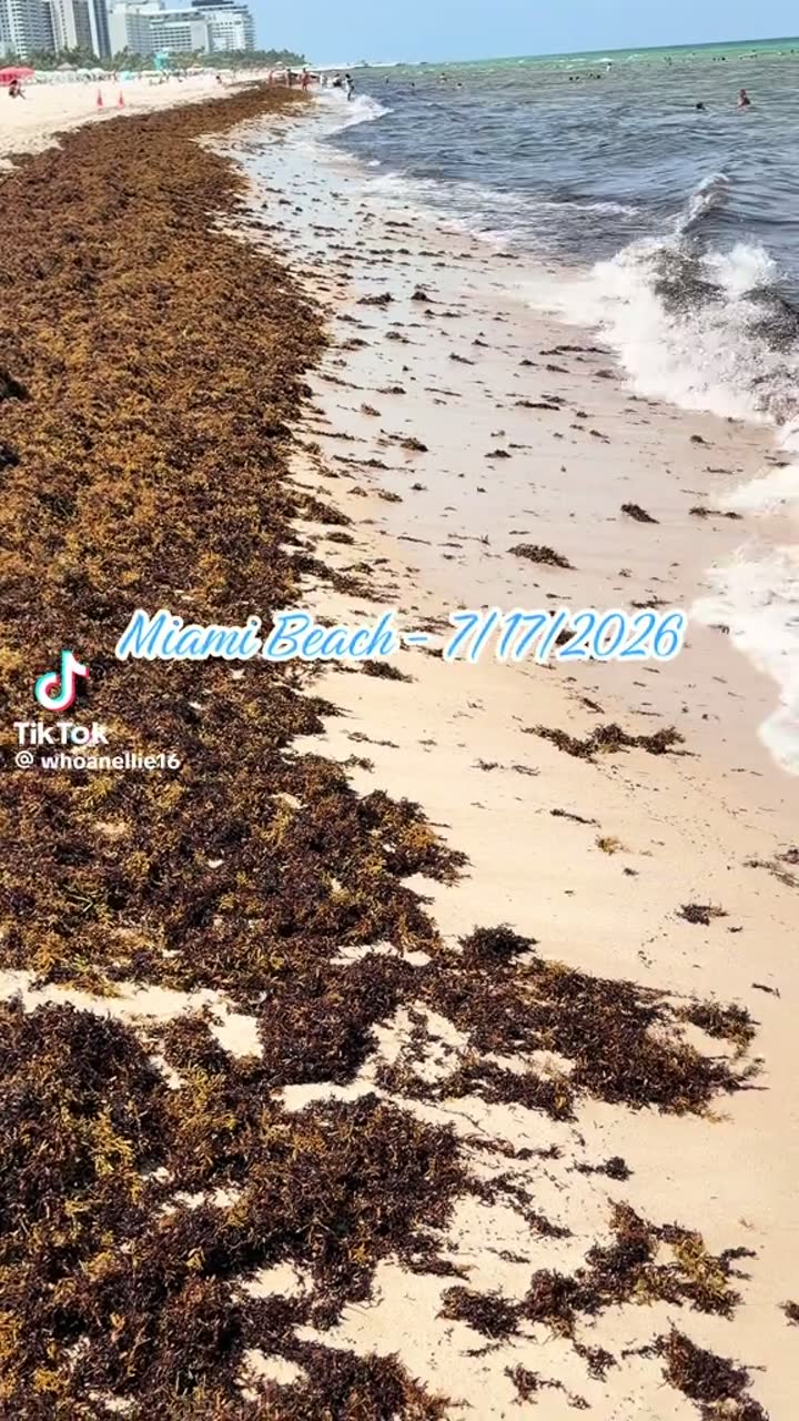 🇺🇸 United States
tiktok · @whoanellie16 · 17 Jul 2026
Miami Beach, 17 July 2026
Miami Beach, Florida
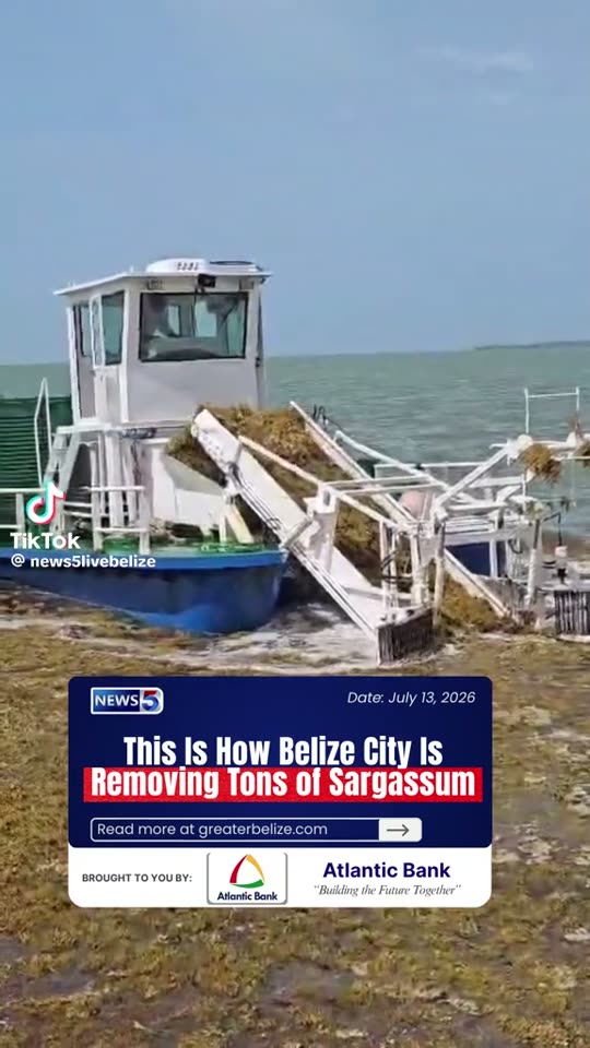 🇧🇿 Belize
news · @news5livebelize · 13 Jul 2026
News 5: how Belize City is removing tons of sargassum
Belize City, Belize
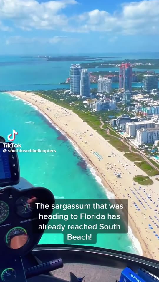 🇺🇸 United States
tiktok · @southbeachhelicopters · 2026
Helicopter view: the belt has already reached South Beach
South Beach, Miami Beach, Florida
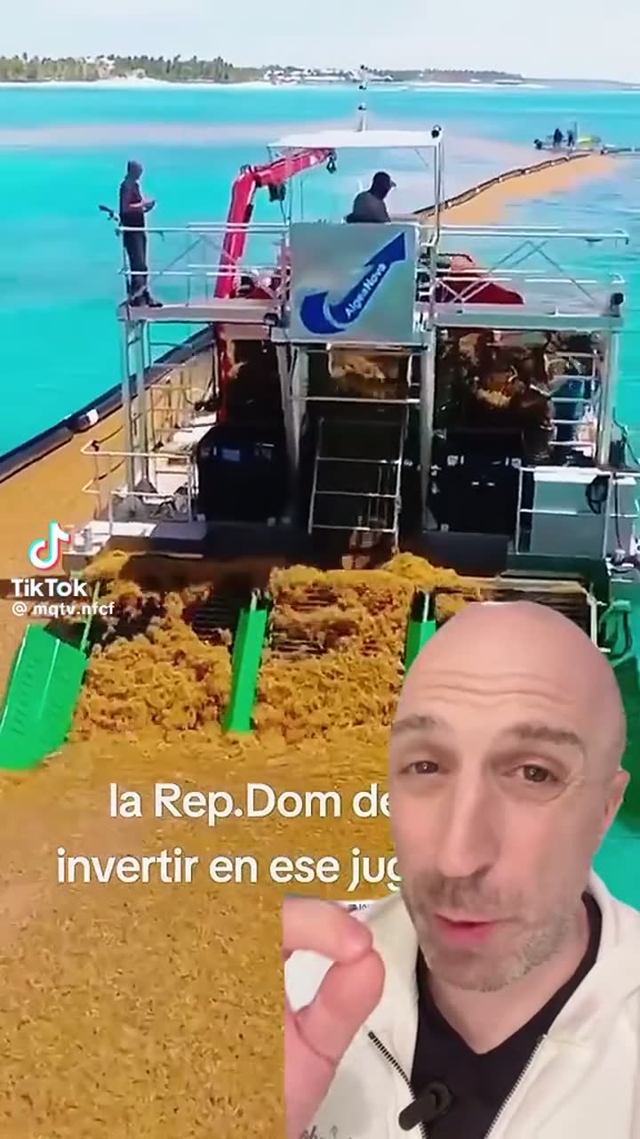 🇩🇴 Dominican Republic
tiktok · @mqtv.nfcf · 2026
Offshore harvester working a boom line in the Dominican Republic
Punta Cana coast, Dominican Republic
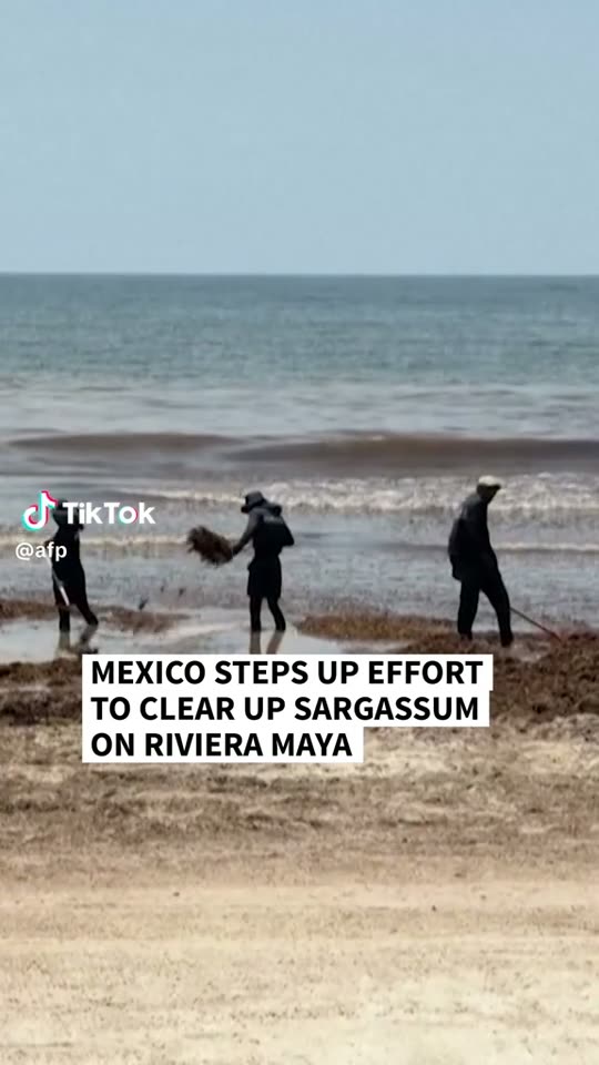 🇲🇽 Mexico
news · @afp · 2026
AFP: Mexico steps up the clean-up on the Riviera Maya
Riviera Maya, Quintana Roo
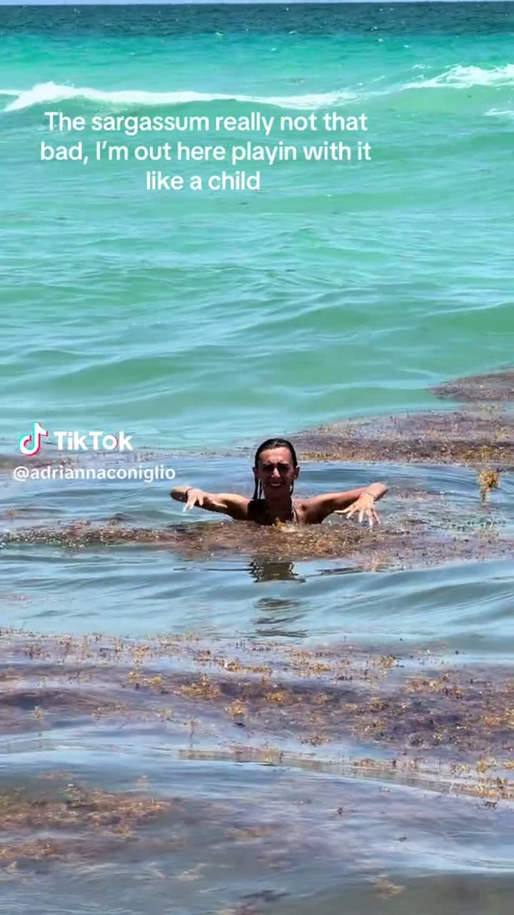 🇺🇸 United States
tiktok · @adriannaconiglio · 2026
“It's really not that bad” — swimming through the drift
Florida Atlantic coast
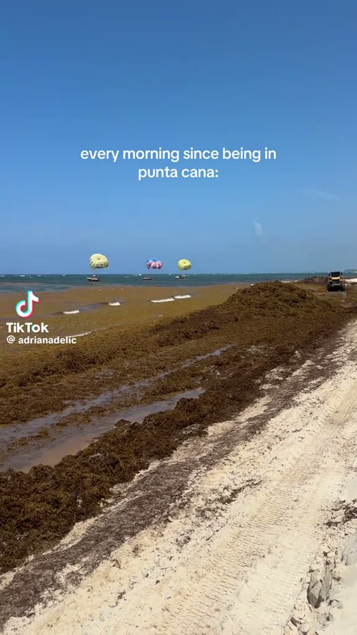 🇩🇴 Dominican Republic
tiktok · @adrianadelic · 2026
“Every morning since being in Punta Cana”
Punta Cana, Dominican Republic
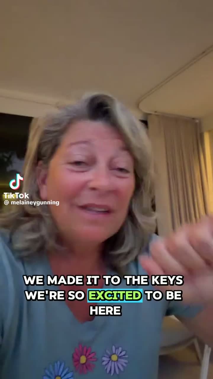 🇺🇸 United States
tiktok · @melaineygunning · 2026
Arriving in the Keys to a sargassum season
Florida Keys
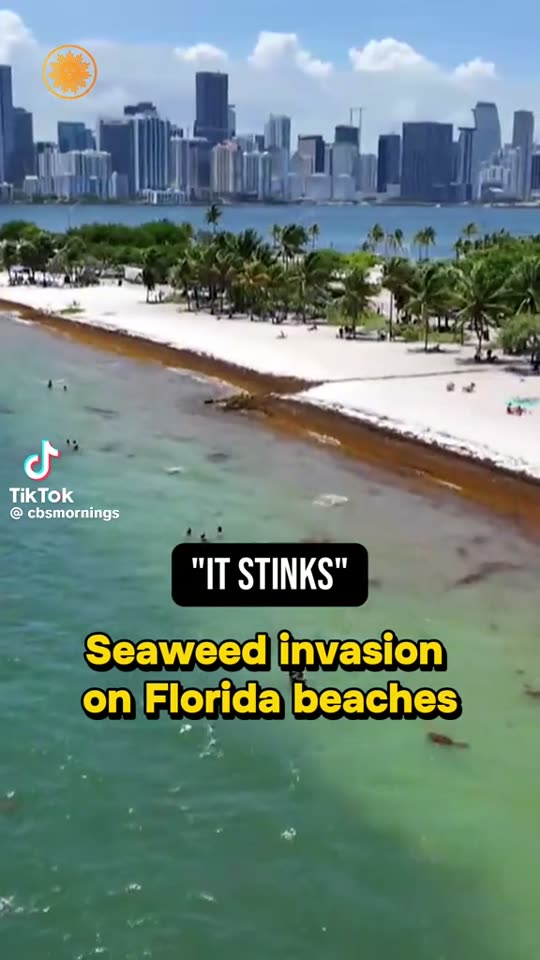 🇺🇸 United States
news · @cbsmornings · 2026
CBS Mornings: “It stinks” — seaweed invasion on Florida beaches
Virginia Key, Miami, Florida
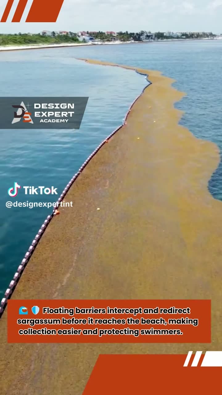 🇲🇽 Mexico
tiktok · @designexpertint · 2026
Aerial: floating barrier holding a mat off the shoreline
Mexican Caribbean nearshore
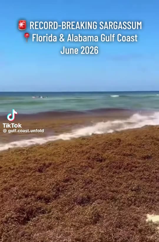 🇺🇸 United States
tiktok · @gulf.coast.unfold · Jun 2026
Record-breaking sargassum on the Florida & Alabama Gulf coast
Perdido Key, Florida–Alabama line
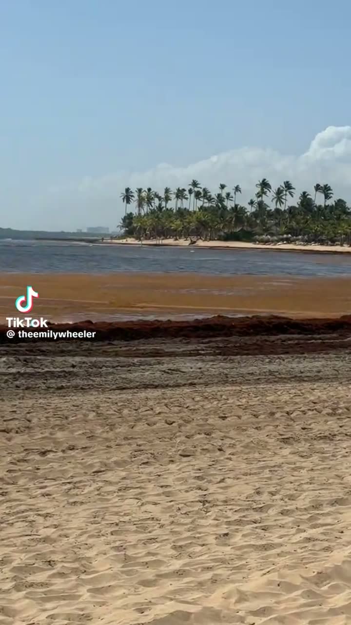 🇩🇴 Dominican Republic
tiktok · @theemilywheeler · 2026
A brown band where the shallows should be
Dominican Republic north coast
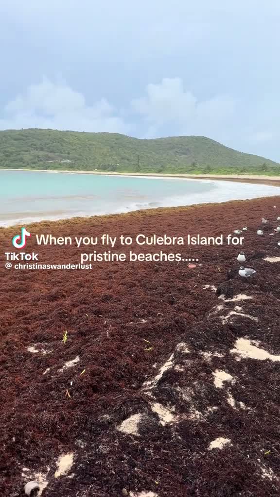 🇵🇷 Puerto Rico
tiktok · @christinaswanderlust · 2026
“When you fly to Culebra for pristine beaches…”
Culebra Island
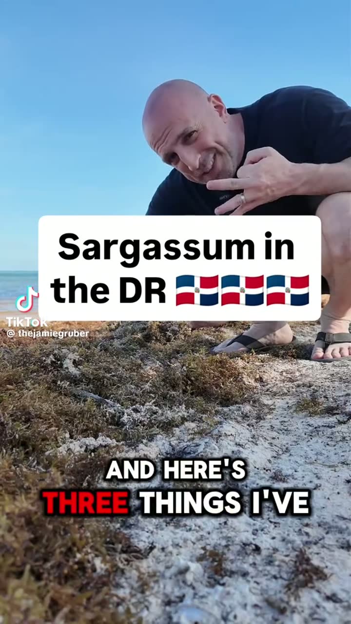 🇩🇴 Dominican Republic
tiktok · @thejamiegruber · 2026
Three things about sargassum in the DR
Dominican Republic
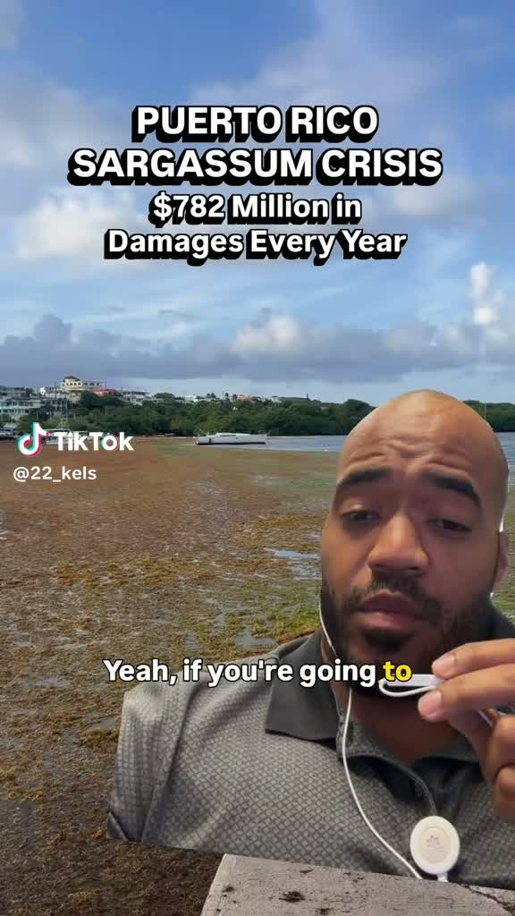 🇵🇷 Puerto Rico
tiktok · @22_kels · 2026
Puerto Rico: $782M in damages every year
Puerto Rico
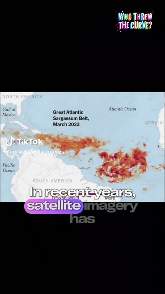 🌍 Atlantic basin
tiktok · @curveballchronicles · 2026
Satellite imagery explainer: the Great Atlantic Sargassum Belt
Africa to the Gulf of Mexico
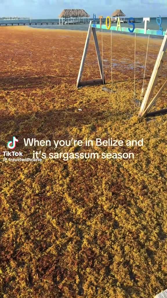 🇧🇿 Belize
tiktok · @travelwithcane · 2026
“When you're in Belize and it's Sargassum season”
Belize coast
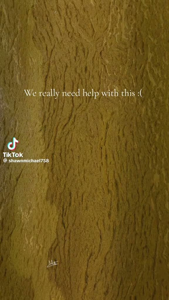 🌊 Caribbean Sea
tiktok · @shawnmichael758 · 2026
“We really need help with this”
Eastern Caribbean, open water
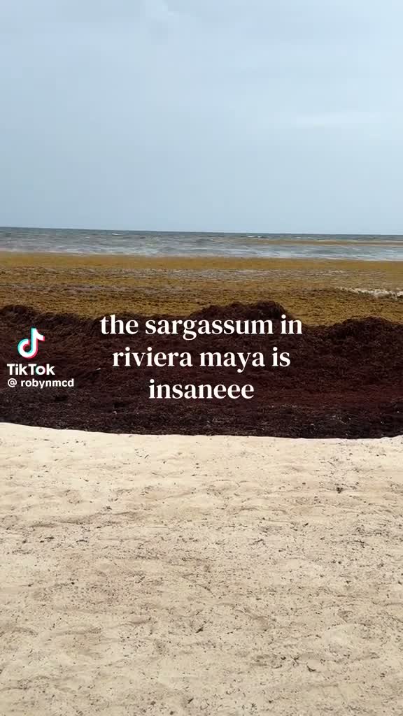 🇲🇽 Mexico
tiktok · @robynmcd · 2026
“The sargassum in Riviera Maya is insane”
Riviera Maya, Quintana Roo
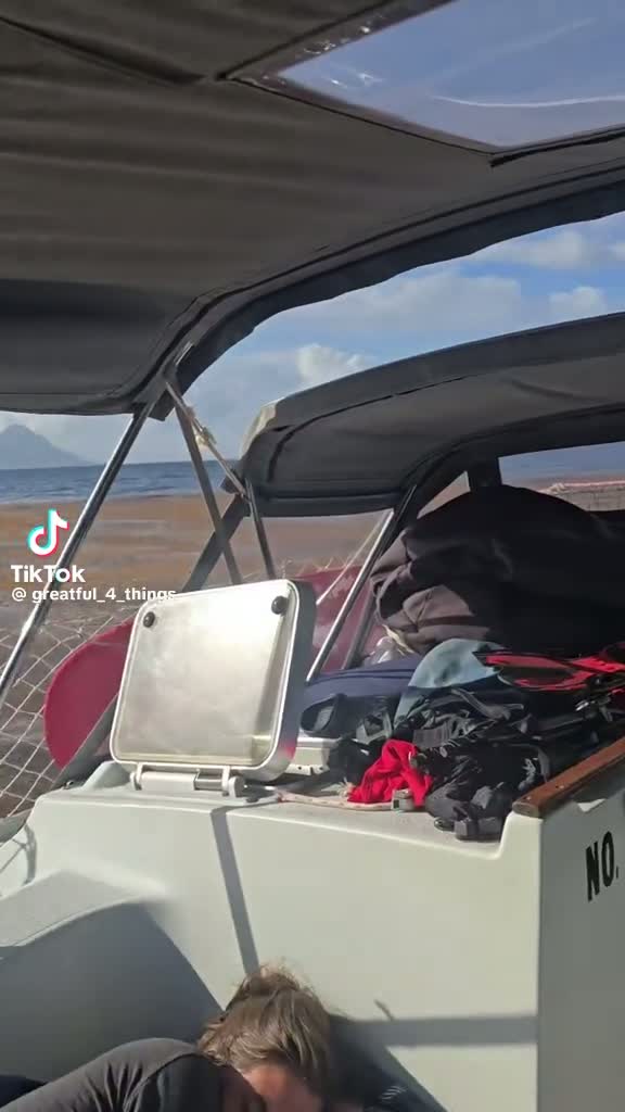 🌊 Atlantic Ocean
tiktok · @restful_4_things · 2026
Sailing through the belt
Mid-Atlantic passage
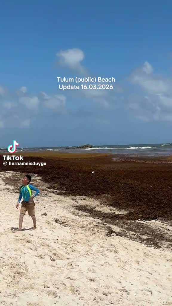 🇲🇽 Mexico
tiktok · @hernameisduygu · 16 Mar 2026
Tulum public beach update
Tulum, Quintana Roo
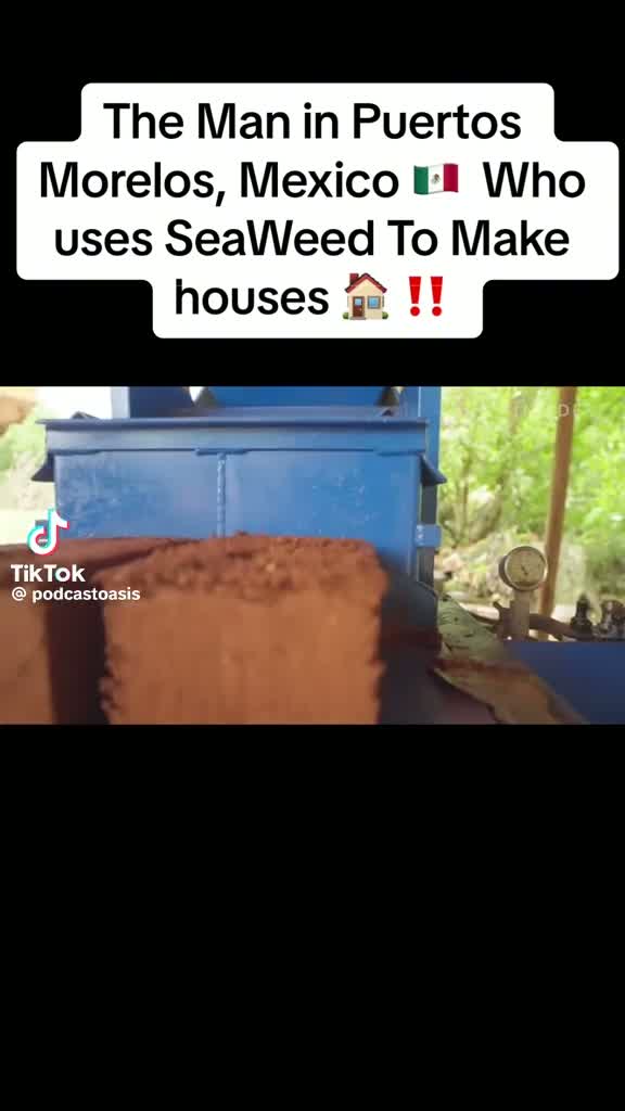 🇲🇽 Mexico
tiktok · @podcastoasis · 2026
The man turning Sargassum into houses
Puerto Morelos, Quintana Roo
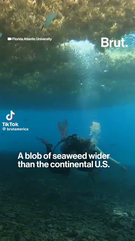 🌍 Atlantic basin
tiktok · @brutamerica · 2026
A blob of seaweed wider than the continental U.S.
Great Atlantic Sargassum Belt
International
One coastline, many flags
Sargassum lands on Caribbean islands, Mexican and Central American shores, West Africa, Brazil and the United States within the same season. Every flag below is a shoreline already living it. Tap the ones you live on or travel to — we will move that shoreline's news, photos and video to the top for you.
Five ways to move
Sign the policy statement, identify role and geography, verify email, and choose whether a name or organization may appear publicly.
02Create a personal referral link; send the campaign to neighbors, customers, guests, colleagues and elected officials.
03Fund evidence collection, public education, local organizing, scientific review and policy engagement through a transparent hosted payment flow.
04Submit a firsthand experience, photograph, video, business record or environmental observation with consent and source details.
05Find community resources, report incidents, join a local group, host a meeting, request public records or pursue a municipal resolution.
Live
We monitor Reddit, Facebook, X and regional news, archive screenshots so the record survives deletion, and publish nothing without moderator review.